
What is GPS?
A. GPS consists of three segments – the satellite constellation, ground control network, and user equipment.
 The satellite constellation comprises satellites in low earth orbit that provide the ranging signals and navigation data messages to the user equipment. The ground control network tracks and maintains the satellite constellation by monitoring satellite health and signal integrity and maintaining the satellite orbital configuration. Furthermore, the ground control network also updates the satellite clock corrections and ephemerides as well as numerous other parameters essential to determining user position, velocity and time (PVT). The user equipment receives signals from the satellite constellation and computes user PVT. More details on each of the aforementioned GPS segments are provided below.
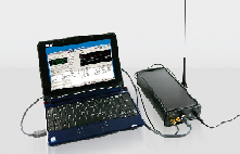 Video Audio Design UEB400DXP-GPS – Receiver, Recorder and Analyzer for DAB signals The UEB 400 DXP allows the user to receive DAB signals according to ETSI EN300 401
GPS Satellite Constellation:
The baseline satellite constellation consists of 24 satellites positioned in six earth-centered orbital planes with four operation satellites and a spare satellite slot in each orbital plane. The system can support a constellation of up to thirty satellites in orbit. The orbital period of a GPS satellite is one-half of a sidereal day or 11 hours 58 minutes. The orbits are nearly circular and equally spaced about the equator at a 60-degree separation with an inclination of 55 degrees relative to the equator. The orbital radius (i.e. distance from the center of mass of the earth to the satellite) is approximately 26,600 km.
With the baseline satellite constellation, users with a clear view of the sky have a minimum of four satellites in view. It’s more likely that a user would see six to eight satellites. The satellites broadcast ranging signals and navigation data allowing users to measure their pseudoranges in order to estimate their position, velocity and time, in a passive, listen-only mode.
![]() Pendulum Instruments GPS-12RG Rubidium Frequency Standard – GPS-disciplined Rubidium clock for near-Cesium stability Internal battery for increased oscillator stability
Pendulum Instruments GPS-12RG Rubidium Frequency Standard – GPS-disciplined Rubidium clock for near-Cesium stability Internal battery for increased oscillator stability
Ground Control Network:
At the heart of the Ground Control Network is the Master Control Station (MCS) located at the Schriever (formerly named Falcon) Air Force Base near Colorado Springs , Colorado . The MCS operates the system and provides command and control functions for the satellite constellation.
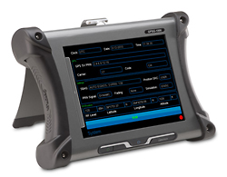 Aeroflex-IFR GPSG-1000 – GPS/Galileo Portable Positional Simulator. Time-saving portable test set.
The satellites in orbit are continuously tracked from six USAF monitor stations spread around the globe in longitude: Ascension Island , Diego Garcia, Kwajalein , Hawaii , Cape Canaveral and Colorado Springs . The monitor stations form the data collection component of the control network. A monitor station continuously makes pseudorange measurements to each satellite in view. There are two cesium clocks referenced to GPS system time in each monitor station. Pseudorange measurements made to each satellite in view by the monitor station receiver are used to update the master control station’s precise estimate of each satellite’s position in orbit.
User Equipment:
The user equipment, often referred to as “GPS receivers”, captures and processes L-band signals from the satellites in view for the computation of user position, velocity and time. (www.faa.gov)
Latest posts by Mike Novello (see all)
- Used Bio-Rad Gel Doc XR For Sale - March 9, 2022
- CONSULTIX WTX-35-A4 CW Test Kit For Sale - November 9, 2021
- Biologic SP-150 Single Channel Potentiostat and VMP3B-80 Booster For Sale - September 7, 2021